


SMART Permaculture in South Ethiopia (Part 1)
A few years back I got an email from a German guy called Oliver Kopsch. He works setting up water and sustainable energy projects in developing countries around the world. He had set up such a project in south Ethiopia – a water-well with solar powered pump to distribute water to the local rural community. Now he was expanding on his concept to include two new features; WASH (Water, Sanitation and Hygiene) and Permaculture.
Before he got in touch with us Oliver had facilitated the establishment of a local NGO, based in the Hadiya Zone of South Ethiopia, called SMART (Sustainable Management and Appropriate Technologies). He had then organised donor funding from a German foundation called Antonia Ruut Stiftung, to establish a project, to be operated by SMART, at a rural site called Hafto, in Shashogo Woreda, the northern part of Hadiya Zone. The project comprised a well, a pump powered by a bank of 12 solar panels and a kiosk to distribute the water to the local community in the area. Prior to this people only had access to pond and river water, so you can imagine it was a sanitation nightmare. The benefits for the surrounding community are huge and more than 2000 people were using the kiosk per day in 2012. SMART sells water very cheap (< $0.01/litre) and the income from the water sales funds operation and maintenance by the NGO. They also offer a charging service for mobile phones (there is no electricity in the area either). The donor’s vision is to establish economically self-sustaining projects that don’t rely on external funding for operation and maintenance once the initial investment has gone down. Hence SMART operates solely on revenues from these income streams.
SMART put in a second well at another site close to the town of Jamaya the following year. After this was when Oliver got onto us. Now he wanted to broaden the concept beyond just water supply to include water use (WASH) and re-use (food production). So in 2012 I came in and produced an initial Permaculture site design for the Hafto site which was later updated. I handed this over to SMART and didn’t hear much from them for the next year or so. Then in 2013 Oliver came to Konso and did a PDC himself with us at Strawberry Fields Eco Lodge (SFEL). He brought with him Tesfaye who was at that time the guy running the Hafto site garden.
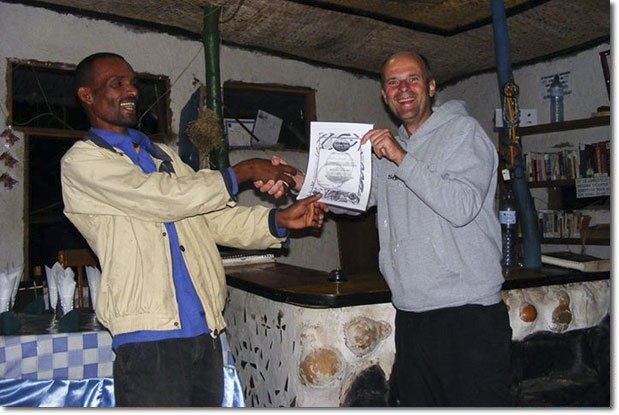
Let me tell you a bit more about Oliver. He’s an intensely excitable kind of guy that is continually building Lego-like concepts in his very practically oriented imagination. These relate to pretty much everything from logistics, management and planning to technical systems design and gadgetry. Oliver is a concept building machine. He’s continuously machinating on some new scheme for developing, modifying, facilitating or expanding some aspect of his projects. And all his projects relate to helping poor people get access to water, energy and food. From an Ethiopian perspective he’s pretty well built physically, at least he usually is when he first shows up (he comes out here a lot), 40 something, not much hair on his head, and like we imagine most Germans to be he’s a very frank kind of guy. He’s polite, positive and friendly and he does have a sense of humour too, at least by German standards, if not much of one by Irish standards! So here is the man himself:

Oliver
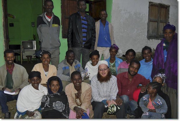
One day in September 2013, Oliver rolled on down to Konso. Konso is little country in the deep dusty south, perched on the last rocky remnants of Ethiopian plateaux as one descends into the pastoralist badlands of northern Kenya, Omo, Turkana and the likes, where we were running a PDC at the improbably named Strawberry Fields Eco Lodge (an awkward throw-back to my hippy-backpacker days). So, anyway on that PDC I was assisted by Asmelash Dagne as a co-teacher and translator for the local participants who could not speak English (who included Tesfaye, the SMART gardener from Hafto).
Oliver and Tesfay at the PDC graduation
Asmelash is an interesting character. He had been working with Permaculture in Konso since back in 2009. He is a young and extremely smart (pun intended) science teacher, who’s nickname is “Best”. He has in the past been likened to “young Eddy Murphy”. He comes from the dusty and frankly very poor little town of Gato, a small settlement which lies on the road south between Arbaminch and Konso (around 550mk south of Addis Ababa). Asmelash has worked his way up from the bottom, and he is still climbing the ladder. He was a teacher at Debena Primary School when the Zimbabwean Permaculture trainer, educationalist, headmaster and veteran both the Rhodesian colonial education system and more latterly of the SCOPE Program, Tichafa Makovere, had come to Ethiopia to work with us at SFEL. The lean and learned Zimbabwean had shown up right on time to help me as I was seriously struggling to get the eco-lodge open and functional as a business, PC site and training centre. He had gone on to initiate our local community outreach program the Permaculture in Konso Schools Project (PKSP).
Asmelash was amongst the first batch of teachers trained in March that year. He then went on to establish the best school garden of the 7 schools which entered the PKSP during the first two years. He was subsequently promoted to teach in Konso Secondary School, where he established another Permaculture garden. Now being close at hand, he was frequently available to assist with our PDCs at SFEL. By 2012 Tichafa had moved on from Ethiopia and I was leading PDCs in Konso myself, with Asmelash usually assisting.
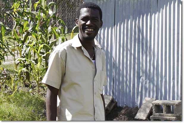
Asmelash
Then, in 2013, Oliver came down to Konso, in September. He was able to learn to use the Permaculture design process during the PDC, as one would expect, and set about enthusiastically expounding, in avid and meticulous detail, his visions for developing SMART’s projects further. As a Briton it’s just too tempting to pass over the chance to chuck in a hint or about certain historical references when Germans start expounding on their dreams of building empires, but the SMART Empire of Oliver’s vision is a brilliant and wholesome one for sure!
And so things continue to grow. In February this year Oliver was onto us again to go up to Hadiya for a site visit and consultancy. This time he wanted Asmelash to come too, and what’s more, he wanted him to stay and manage SMART’s Permaculture department on a permanent basis. SMART was bringing in a third site at Biramora Kamo, so they needed a site design, which would include a solar well, WASH facility and food production. They also wanted a design update on the Hafto site, which had been plagued by flooding. You can see these two design consultancies here and here. I did the site designs and Asmelash stayed on to do ground work. And it worked fantastically. You can see progress on the ARS website.
But now what I really want to tell you about is the projects we are working on right now, as Oliver’s SMART vision expands and unfolds itself even further into concrete reality in fits and starts. Success needs scale-up and replication. I mean, don’t get me wrong like any visionary, there is always way more stuff that he cooks up which never happens than actually makes it into the realm of actual existence, but, you know, he gets by with a little help from his friends. I like to think that I am one of those friends, helping him crystallize his ideas into existence, as are Asmelash and all the other people who work for SMART on the ground.
Anyway, his long term vision is to have water, WASH and Permaculture centres, providing clean drinking water, washing, sanitation facilities and food production using treated waste water, every 5–10km, with over-lapping catchment areas, providing basic vital living services to the rural community right throughout Shashogo Woreda. Then he wants to start on the other woredas in Hadiya Zone. And eventually he wants to Permablitz the entire the entire country! Sorry, I got a bit carried away there…
The initial site, at Hafto, was incredibly remote necessitating a 2 hour drive out into the countryside along terrible roads which are often flooded in the rain season and dusty as hell in the dry season, so not very convenient. So, in order to administer an expanding network of projects effectively SMART would need to establish a new command and control centre, sorry I mean a new administrative office, in a more accessible location. Quite logically, he chose the administrative town of the Shashogo Woreda, which is called Bonosha, where an Italian NGO called LVAI, previously based in the area, had constructed a Guest House on a 1000m2 site for use by visiting development workers. They had handed it over to the local government when they left in 2012 and it had been locked ever since.
It is the perfect site for an office for SMART. What’s more if SMART has an office there, it may as well set up a centre for training people to operate the new projects that are entering the SMART project network, on an on-going basis, in the technical skills necessary for operating such projects, like solar power maintenance, plumbing and Permaculture techniques. Then if you are training locals in these techniques why not establish an international standard training and demonstration site so that you can train staff from other NGOs as well, and get additional income for the organisation? Great idea…
So Oliver called me in again this month (Asmelash is now already there full time) to visit the new site and help develop the ground plan, together with Asmelash, for the SMART Permaculture and Appropriate Technology Training Centre in Bonosha. And this is how it went…
Background
(Yes, more background) Bonosha is a mid-sized market town of estimated 10,000 population in Hadia Zone around 250km south of Addis Ababa. The project location is around 200m to the east of the town market place and main-street, which is a newly surfaced asphalt road running 25km south to the town of Halaba. The agro-climate of area is classed as mid-highland (“woina dega”) with an altitude of around 1800masl. The GPS coordinates of the site are: 7o30’23.0”N 38o5’52.2”E. The predominant tree species grown in the area are Juniperus, Eucalyptus and Gravillia robusta. Local farmers mainly grow maize, wheat, teff, sorghum, pees and red pepper. Most agriculture in the area is monoculture nowadays dependant on chemical inputs. Rainfall and temperature data are not available, but estimates are: rainfall around 1500mm and mid-day average temperature in the low 30soC in dry season and low 20s in rain time.
Objectives
SMART-Ethiopia has assigned its Permaculture department the task of developing a “retrofit” design to make use of the existing infrastructure on the site as well as develop additional systems to address two broad objectives:
-
I. To develop a DEMONSTRATION SITE for an intensive and self-sustaining HOME GARDEN, relevant to the local community context.
II. To develop an international standard appropriate technology training centre to train and demonstrate skills and technologies relating to WATER, SANITATION, ENERGY and INTENSIVE ECOLOGICAL FOOD PRODUCTION (PERMACUTLRUE.
Goals
I. A home garden demonstration site, relevant to the community context should fulfil the following goals:
-
a. Demonstrate more intensive use of land than is currently practiced under local agriculture and home gardens
b. Use a greater diversity of species for producing food
c. Produce a greater range of products such as spices, medicines, fodder and fibre
d. Demonstrate effective water management including rainwater harvesting and efficient water use systems
e. Demonstrate recycling of domestic wastes for nutrient and energy recapture
f. Yield a high calorie and vitamin output from the space used
g. Produce a viable economic yield from the space used
h. The site should be able to host workshops for local community (we aim for 4 local community workshops per year from 2015)
II. An international standard biotechnology training centre should fulfil the following goals:
-
a. Provide living accommodation for international student groups
b. Provide catering facilities for international student group
c. Provide teaching and learning facilities for international student groups
d. Host model water and energy systems for training solar and water technicians/trainers
Site Survey
Dimensions, shape, orientation
The site is approximately rectangular with the long axis of 40m running approx east to west tipping about 10o to the SE. The site is currently 27m wide, but an expected reduction of 2m along the southern boundary due to road expansion should leave the site at 25m across in the coming years. The site boundaries are straight edges between the four corners.
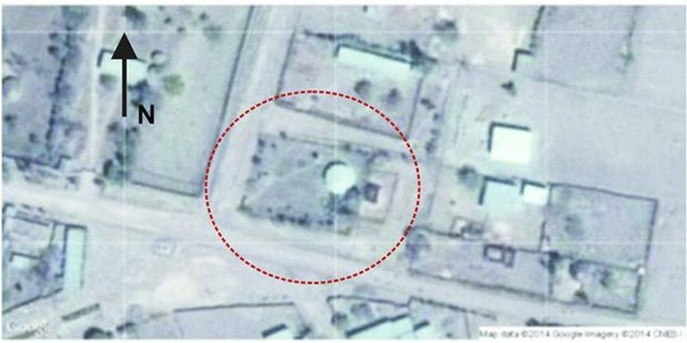
Map 1: The Site on Google Earth

Map 2 – The Bonosha Guest House Site Survey Map
Boundaries
The site is fenced with 1mm steel wire mesh, 2m high, supported by split eucalyptus posts, based in concrete. This fence is adequate to keep animals out of the site, but is see-through and offers no shelter from the elements. Along the southern boundary are 11 trees ranging in height from 2–6m. They are planted along the inner edge within 1m of the fence at irregular intervals of 2 – 4m. Species include Cordia Africana (“wanza”), Grevillia robusta, and Casimiroa edulis (“kazmir” or Mexican apple) and a single Melia azedarach (syringa berry-tree). Most of these trees will be outside the site after a planned 2m reduction in the site area due to planned road expansion.

Trees along the Southern Boundary
Along the N boundary there was previously a hedge of Dovyalis caffra (“kushem” or Kei Apple) on the outer edge, as well as some Eucalyptus trees. These have been copped down within the last 6 months. The D. caffra stumps are sprouting coppice re-growth and should re-establish. The eucalypts have died.

The Northern Boundary
Along the E boundary four tall trees (2 Juniperus and 2 Grevillia robusta) are planted along the southern half of the fence at 1m intervals. Along the northern end of this boundary (behind the guest house building) is a growth of shrubs and climbers is over-growing the fence.

The Eastern Boundary
Surrounding Land Uses
The site is bordered by un-surfaced public roads on three sides (N, S and W). The neighbouring compounds beyond these roads are all residential compounds, mostly fenced with bamboo screen. There is a public water facility in a “public square” area to the SW which can be seen on the Google Earth Image (Map 1, above).
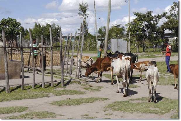
Cattle around the water-point in public square (site entrance can be seen in the background)
The eastern site boundary is next to an open area in which a local family has established a cattle pen backed onto the site fence. Beyond this is a flat depression in the ground which has filled with water to for a swampy area of around 5 x 5m. Beyond this again are residential compounds fenced with bamboo screen. The animal owners have dug a small pond just outside the N corner of the site to catch rain-runoff water for their animals.

Small pond dug by neighbours outside northern corner of the site to harvest run-off water for their animals
Access
The site entrance is currently located in the SE corner of the site. The public roads bordering the site on 3 sides (N, S and E) lack purpose built drains. Water run-off from the neighbourhood flows past the site along all three roads, especially passing the S boundary, which is the major rout to the market-place. This water has eroded a gully in the land surface, preventing vehicle access into the site.
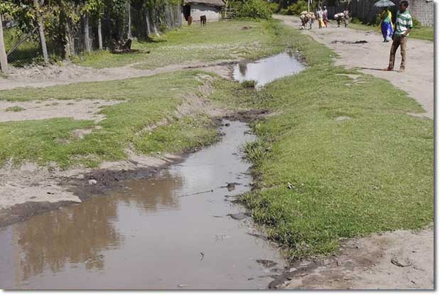
Eroded depression running along SE site boundary blocking vehicle access to site entrance at the southern corner
Sector Analysis
Sun
The sun rising from the east has an average year-round zenith angle of approximately 10 deg south of vertical. Hence northerly aspects of buildings will tend to receive more shade over the whole year. However, in the tropics, the sun will move into the northern half of the sky during the winter months and hence shine onto north facing walls. The effects of direct sun-shine will tend to be greater during the dry season when trees may reduce or shed their foliage. The dry season is usually from September to March (i.e. during the winter months). Thus we should consider northerly aspects to be more affected by the sun in the dry season and southerly aspects to receive sun in rainy season. Despite the flat aspect of the site the tall trees along the NE boundary, as well as the existing guest house building itself, cast a degree of shade over the NE half of the site in the morning.
Wind
Neighbouring families have reported that the main wind is from south-west in the rain season and from north-east in the dry season.
Water Flows
There is no run-on onto the site due all water flows from the surrounding are directed past the site boundaries (see: the section on Access). Since the site is flat there is little evidence of erosion. Water leaving the site as run off from the roofs of the existing buildings is exiting at the SE corner where the site entrance is currently located and joining the flow of water along the main road on the S boundary running to the west. Piped water is entering from the SE corner and running to the 2000L tank currently located to the east of the existing guesthouse building.
Sensory Influences
Current site fencing allows full view in from the outside and visa-versa, particularly along the N, S and E boundaries. The W boundary is currently blocked by the cattle pen. Visual access to the site may, on the one hand, be beneficial for the local community demonstration objective. However, on the one hand, it may pose a privacy concern for international guests, since the local population are apt to stop and stare at foreigners. Hence some manipulation of the “visual access” is required.
The presence of the cattle pen on the E boundary may present an issue with smell in the dry season when a build-up of dry manure can lead to amonification.
Internal Situation Analysis
Topography
The site is essentially flat. There is a general fall in the landscape from E to W as evidenced by the direction of flow of run-off water along the site boundaries. However, the movement of water inside the site appears to be in the opposite direction.
Soil
The soil type is grey sandy clay, known locally as “bulla afer”. It is dense and has very good qualities for construction. It does not crack in the dry season hence tends to retain water well below the surface. It is also of good fertility for cultivation and contains some organic matter.
Vegetation
The central area of the site, extending between the guest house building, the guard house and the site entrance is grassed. The peripheral areas of the site to the N, W and S are all cultivated and planted with crop, mostly maize. The cultivated area extends inwards from the site periphery from 3 to 5 meters where it meets the grassed interior on all sides except the SE corner (where the entrance is located).
In the NW corner of the site there is an abundance of herbs, some small trees, shrubs and creepers which have grown up over the fence. This is located around one of the two sceptic tanks.

The NW Corner (at the end of the rain season)
There are around 20 trees on the site which are of more than 2m height, comprising at least 10 species. The larger individuals are shown on the site survey map (Map 1). Most of the trees are distributed along the inner edge of the S and E boundaries. (Refer to previous section: Boundaries).
Structures
The existing structures are:
• The guest house (8m diameter circular, concrete and cinder-block, corrugate iron sheet (CIS) roof)
• The guard house (2 x 2m wood-pole CIS roof and walls, no foundation)
• 2000 L water tank on concrete tank stand (2.5m height)
• Two underground septic tanks
Water
There is no evidence of heavy runoff causing erosion on the site itself. (Refer to previous sections Boundaries and Sector Analysis).
The main water store on the site currently is the (2000litre) tank which stands on a 2.5m stand to the west of the guest house building. This tank cast shade around itself but does not have any appreciable thermal mass. The two cess-pit tanks on the site similarly have no thermal effects, being underground. There may however be some seepage from the tank in the north-east corner as evidenced from the fact that there is abundant growth of vegetation in that area. However this may also be due to the area getting roof run-off from the guest house as well as plenty of sun-shine during the latter part of the rain season.
Summary of Microclimates
NW corner – this area lies between the existing guest house building and the NW site boundary. It gets afternoon shade in the rain season, at which time it also gets a lot of water from roof run off from the guest house. There is also a sceptic tank (which is actually a cess-pit infiltrating waste water into the ground) here which probably adds to the moisture content and nutrient availability in the area. Hence it is an extremely moist, shaded and highly vegetated area at the end of the rain time. However going into dry season it may get more sun as the sun swings north during the winter months.
West End – the west end of the site is dominated by 4 large trees (Juniperus and Grevillia) which shade the area from the morning sun. However except for the NW corner the west end does get afternoon sun. There are no appreciable wind breaks here as with most of the site, but there is also no clear sign of any strong wind effects on the site.
The Southern Border – this area is shaded under a canopy of Cordia africana and G. robusta) throughout the day.
The rest – of the site is pretty much open, flat and exposed to full sun for most of the day as the situation stands. The major effects are due to the presence of the existent structures and the vegetation. There are no appreciable landscape effects.
Resources
On-Site Resources
The major mineral resource on the site is the sandy-clay soil which is of good quality for construction work. The same soil is present through most of the town and the local community use it for house building without any need for much pre-preparation. The soil is usually used in with the standard Ethiopian cob over a timber frame technique. However there is one good example of the soil having been used in a cob-brink structure which has proven both robust and resistant to weathering. Tests of the material would be necessary to see if the soil on the site is of good enough quality for brick making. Using this material may serve the dual purpose of excavating a pond or tank. However if the site soil is not of good enough quality, local enquiries are necessary to determine which soil deposits are of the best quality in the area.

Clay recently dug out for use in mud walling
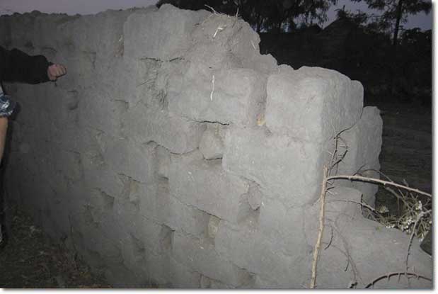
Cob brick wall in Bonosha Town showing impressive resistance to weathering even without any roof over it for protection
There is also potentially a small timber resource on the site in the form of the long Juniperus and Grevillia trees planted along the E and S edges of the site.
Local Physical Resources
All the basic bulk materials required for construction are available locally for delivery by truck or by donkey cart including: stone, sand, pole timber and cement. The latter would be cheaper if brought from Addis Ababa or Awassa (the regional capital).
Human Resources
It was not possible to assess the local HR demands for potential products from the site during the short time we conducted this survey. However, there appears to be abundant unskilled labor available in the area with the daily laborer’s wage rate estimated ETB 30 – 50 per day. Skilled employees should also be available locally having been trained in the government or NGO sectors, if not they can be sourced from the zone or regional capitals.
Markets
In terms of market demand most of the income forecast for this project is likely to come from the training programs that would be run here for NGO staff and international trainees. The site is too small for real commercial production for local sales, however it could act as a vending centre for produce from the more rural sites in the SMART project network if they have surplus product, and the produce would undoubtedly command a better price in the town than in the countryside. The town has a large market which must employ a small merchant community as well as being an administrative town so the government workforce will also have salaries enabling them to spend more cash on better quality food than the rural farmers who are often struggling to stay above the breadline. However, more reliable facts and figures on this should be collected by SMART themselves.
OK, so that is the site survey done and we will go through the design in the next instalment! Watch this space… Oh yea, if you want to learn more about Permaculture for development projects I am running a 5-day course on that at Zaytuna Farm in January.
Take a course with Alex!
- Permaculture for Development Aid: 5-day Course with Alex McCausland at PRI Zaytuna Farm, NSW, Australia (Begins January 19, 2015)


Thank u Alex indeed!